Archives for May 2017

Days Six and Seven – Iguanas and Coral; Stromatolites and Slime

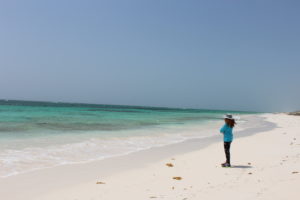
San Salvador shows us glimpses of both a beautiful tropical paradise and a rugged and, at times, harsh landscape. At no time (so far) has this dichotomy been more apparent than the difference between Day Six and Day Seven on the Island.

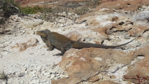
On Day Six, the students boarded a small boat in Graham’s Harbor and were driven one mile across calm, teal green waters to Iguana Island, a large rock in what feels like the middle of the ocean, inhabited by approximately 100 iguanas.

A resident of Iguana Island.

Instructions: they will bite if you mess with them – after happening upon one (or more), just squat down and settle in to view them as they go about their business. Some students were lucky enough to see the elusive blue iguana, as well as groups of iguanas chasing each other over the jagged rock surface.

After their time with the reptiles, it was on to the biggest reef dive yet – two miles offshore. The larger reef meant more diversity in terms of species of corals and other marine life. Though treated to splendid sights, the students also saw firsthand some environmental effects in the form of bleached, diseased corals and stressed reefs.

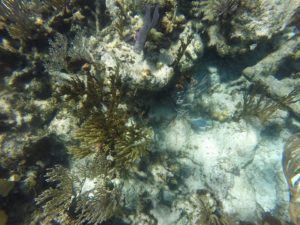
Mustard hill and elkhorn corals, along with sea fans and brain corals are seen along the reef. (photo credit: Jessica Tygett-Self)

Sixuan Wu’s research will look into the corals’ response to overfishing, ocean acidification, and pollution.  Rose Gartner’s research interest lies in the abundance of particular coral species (she will observe the ratios of elkhorn, staghorn, and lettuce corals, the three most common species in the area), as well as investigating the recovery of the reefs following the destruction of 2015’s Hurricane Joaquin.  Alisia Hassler’s study involves examining the effects of rising sea level in the Bahamian platform, of which reef and coral populations will play a large part, along with temperature records and past high and low tide measurements.

It was a remarkable dive and a perfect island day, complete with dolphin sightings on the boat ride back to shore.  It even afforded the students their first official half day off from the field.

Then, along came Day Seven.

The week has been full of new experiences, and the class’s visit to Storr’s Lake was no different.  Except…well, it was really quite different.

Just like the Missouri River, right?
Nope.

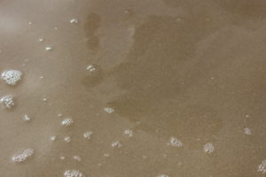
At first glance, Storr’s Lake calls to mind the brown, muddy waters of our own Missouri River and other sediment-laden bodies. Upon further study, however, we learn that the lake’s hypersaline waters are teeming with microbes (living organisms that can’t be fully seen with the naked eye).  The water is so salty and viscous that a sample of it still has suspended particles hanging around after sitting perfectly still in a lab for six months.  Nothing ever fully settles in this environment.

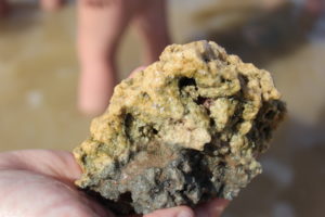
Stromatolites are also found in Storr’s Lake.  Stromatolites are stony structures (they look like rocks) made up of layers of gooey microbial (bacterial, in this case) mats. The mats have cemented after trapping, binding, and precipitating carbonate minerals (Paul et al, 2015).  Dr. Varun Paul, Missouri S&T alumnus, published a paper on these very stromatolites in 2016.

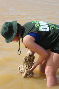
With every step taken blindly through the squishy, gooey sediment along the lake floor, and with every handful of stone-filled sandy clumps of sediment fished out of the water, the students were treated to the up-close look – and feel! – of that layer of biological slime. It covered everything in the water, including the legs of the young geologists as they made their first voyage across one of Dr. Wronk’s favorite spots on the Island.

So salty and slimy is Storr’s Lake that a quick dunk in the ocean was needed afterward – compared to the opaque Lake, the sea felt like freshwater!

One more stop on Day Seven: the United Estates Quarry, where the students added more cross-section sketches to their field book. The ultimate goal is for the class to have seen enough formations by the end of the trip to sketch a detailed cross-section of the entire island – Dr. Wronk’s hopes are high….


See the photos below for more of Days Six and Seven!
 

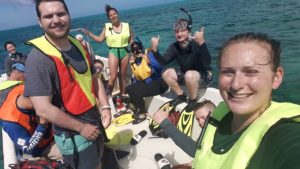
Suiting up for the reef dive. (photo credit: Alisia Hassler)


More corals from the diver’s perspective. (photo credit: Jessica Tygett-Self)


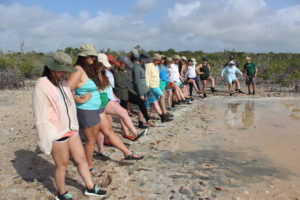
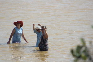
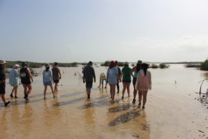
The students are ready to take their first step into the slimy wonder of Storr’s Lake.


Into the fray. According to our alumna, Cherie Telker, wading into your first gooey lake is a true rite of passage for carbonate geologists. They’ve joined the club!
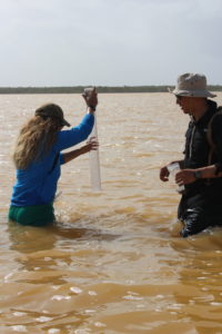
 

Alisia examines the slimy structures.


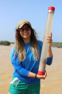
Sara obtains a core sample of sediment from the bottom of the lake for her research project on Storr’s Lake microbialites as Tong looks on.
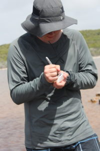
 

Success! And on her birthday, no less. Happy birthday, Sara!


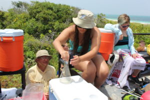
Michael bottles a sample of lake water, one of many for his research project on hypersaline lakes and ponds in San Salvador.


Hard to see it, but there’s a lovely life-affirming layer of goo on there.


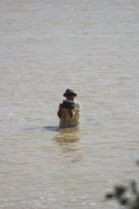
A brave few go back in to take a sample with Dr. Wronk.


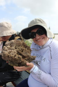
Dr. Wronk proudly shows off a stromatolite, found in his happy place of Storr’s Lake.


Alumna Cherie Telker and her buddy, the stromatolite.


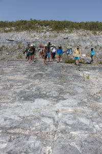
After a quick rinse in the ocean, the students get back to work at the Quarry.


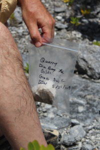
Sample from the Quarry.


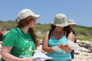
Rose and Audrey, sketching and sketching.


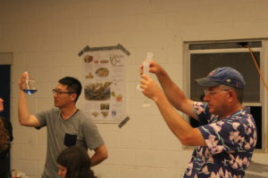
Audrey assists Dr. Wronk with a field titration.


Dr. Witt leads one lab discussion of the day’s samples…


…while Dr. Wronk leads another.


Tong and Dr. Wronk, perfectly in synch.


Until tomorrow….


*Reference:
Paul, V.G., Wronkiewicz, D.J., Mormile, M.R., and Foster, J.S., Mineralogy and Microbial Diversity of the Microbialites in the Hypersaline Storr’s Lake, the Bahamas. in Astrobiology, vol. 16, no. 4 (2016).
Days Four and Five – Highlights and Photo Gallery

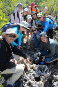
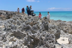
Examining washed up corals at a sea cave on Sandy Point.


left to right: Crystal, Rose, and Alisia inspect the formation of the sea cave.


Sara examining a piece of brain coral.


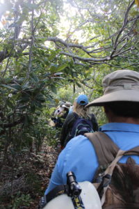
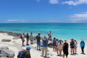
We begin a hike through inland vegetation. The terrain was rough and, at times, made up of jagged carbonate rocks.


Yeah, we’ve been walking on that!


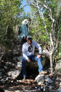
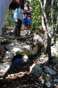
There were at least two caves on this hike. Here, Dr. Witt sits above an opening for scale.


Hans dives in while Jessica (right) suits up to follow.


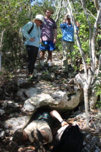
Jessica on her way out. She reported that it went back approximately 200 feet.


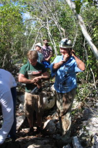
Hans and Jessica, cave conquerors!


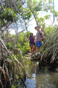
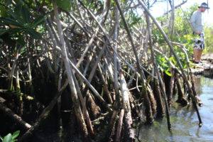
Audrey and Mark during our stop at Oyster Pond. This feature off the hiking trail allowed for swimming among Atlantic oysters, non-stinging jellyfish, and the mangroves (shrubs that grow out of saline waters).
 

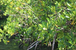
The mangroves.
 

A little bit more of the mangroves.


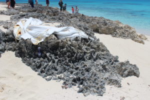
Standing on dead corals, Dr. Wronk puts tape and a tarp over the ‘murder scene’ asking, “What killed the corals?”


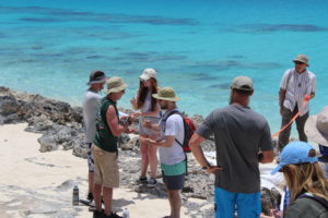
Team captains use rock-paper-scissors to start choosing squads to solve the mystery.


Dead corals. Missouri S&T water bottle for scale.


Dead starlet coral in the foreground; investigating students in the background.


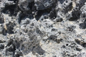
Dead brain coral.


Dead brain coral (cross-section).


The verdict is in: during a sea regression (sea level lowering), these corals no longer had access to water. In effect, they were smothered to death by sand.
More mysteries to solve in the coming days….

Day Three – Highlights and Photo Gallery

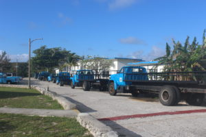
The blue Centre trucks, gassed up and ready to haul researchers all over the Island.


First stop today: the beautiful Bluff. This area was hit hard by Hurricane Joaquin in 2015.


The class observes biology within the geology – fossilized and modern (living) organisms.


Geologist Alisia.


To give an idea of Joaquin’s destruction: all the boulders the class traipsed through were once next to the shore. Massive energy occurred to displace this landscape so.


A little further up from the Bluff, the students sketched cross-sections of the formations and their fossilized and modern biota.


Geologist Sixuan. (photo credit: Cherie Telker)


Geologist Emma. Emma brought along measuring instruments to look at characteristics of cerion snails. Her research project includes comparing fossilized and modern cerion to gain insight into past (paleo) environments vs. present ones. (photo credit: Cherie Telker)


All the geologists, examining the formation with hand lenses. (photo credit: Cherie Telker)


Lunch in the field – dubbed The Palms Restaurant by Dr. Wronk.


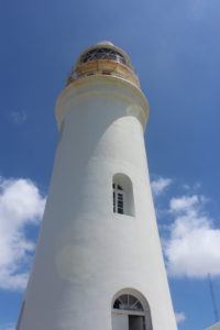
The Lighthouse.


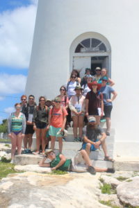
Group photo at The Lighthouse.


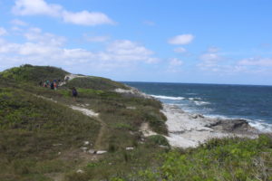
The hike to North Point Peninsula.


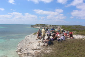
The classroom at North Point to end our day in the field. Not too shabby….


Day Two – First Look at Gerace and San Sal

Off the plane and straight into the field – Day Two wasted no time making its mark.

The one hour flight from Nassau to San Salvador afforded aerial views of island structures and their geologic features in the Atlantic Ocean. For the 60 minutes on the plane, the students’ faces went back and forth between being buried in field guidebooks (provided by Dr. Wronk) and pressed up against the windows for the magnificent sights.

Our chariot for the week.

After touching down at the final destination, the group was greeted by Gerace (pronounced JAIR-ace) Research Centre Executive Director Dr. Troy Dexter and a large flatbed truck. The blue-cabbed trucks and their open-air benches are the primary mode of transportation at the Centre for hauling groups of students to and from field sites.  Sunshine, island winds, and ocean views held the class’s attention during the ride along Queens Highway – a two-lane road that circles the island with no shoulder to speak of – from the airport to their residence for the next nine days.

Lunch was immediately provided and heartily consumed at the Centre’s cafeteria (three squares a day of filling food prepared and served by a patient staff – no small feat considering Gerace will house groups of students and faculty representing at least nine schools during this week alone), followed by a quick orientation. After settling into assigned dorms and rooms, it was time to dive right in – off to the field!

First look at Gerace Research Center.

The beach of Graham’s Harbor is separated from the Centre by only Queens Highway, the narrow main road. With Dr. Wronk leading the way, the class crossed the lane and stepped onto the carbonate geology they’d studied all semester. They promptly got to work, observing and then sketching in their field books the beach slope, grain sizes and types of sediment, rock structures, and biota (living organisms) on the beach.

Since, geologically speaking, the Bahamian platform is quite young, formations seen all over the island originated during the Pleistocene and Holocene epochs. During our current Holocene epoch (younger than the Pleistocene – remember the Nassau caves from Day One?), deposits built up to create what is named the Rice Bay Formation. The Rice Bay Formation is made up of the North Point Member (older) and the Hanna Bay Member (younger), and the beach at Graham’s Harbor belongs to the latter. Essentially, this means the budding geologists were studying a beach that began forming less than 10,000 years ago.

See the figure below for a clear illustration of the stratigraphy, or layers, of The Bahamas.

Figure showing stratigraphy of The Bahamas.

When the snorkels came out and Dr. Emitt Witt had checked for and assured everyone’s safety, it was time to move off the beach and examine the underwater biota. Levels of snorkeling experience were once again varying, but it wasn’t long before all students had their face masks parallel with the ocean floor. In the short time of exploring the marine environment, the students were treated to sightings of underwater grasses, two species of plant algae, multiple species of fish, a few small corals (snorkeling for big time corals will happen later this week), several starfish, and three sea turtles.

Samples of coral (dead ones, of course – no worries about disturbing living habitats with this crew), algae, and sands were brought back to the lab for a quick visual analysis. The class will meet in the lab each evening after dinner to discuss the field studies of the day and to work on their individual research projects. There are 10 labs for student use

Clear, warm, perfect water for a snorkel.

at Gerace; Missouri S&T students get to share lab space with two Ph.D. candidates from University of Southern Florida who have been drilling and collecting core samples on the island since mid-April. The samples are in stacks of meticulously labeled boxes and S&T was given one ground rule:  You may look at the core samples, you can even touch them.  Just PLEASE don’t mix them up!

See the photos below for a closer look at Day Two, and check back for news of Day Three.  Coming up: The Bluff, an area devastated by Hurricane Joaquin in 2015; The Lighthouse; North Point Peninsula; and more spectacular views of carbonate geology.


Almost time to board the plane to San Sal.


Some serious geology happening down there!


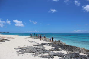
First foray into field study. Graham’s Harbor made a great classroom.


Dr. Wronk sizing up some features with Emma.


Dr. Witt, just being cool.


Geologist Emmy.


Geologists Tong and Mark.


Geologist Sara (center).


Trek to the snorkeling location in Graham’s Harbor.


Our guest alumna, Cherie Telker, lends her expertise and experience to the young geologists.


Talk about some carbonate geology….


Wrapping up with some lab time.
Rolla, owning Lab 7.


*Reference:
Carew, J.L. and Mylroie, J.E., Depositional model and stratigraphy for the Quaternary geology of the Bahama Islands. in Geological Society of America, Special Paper 300, pp. 5-32 (1995).


Day One – St. Louis to Nassau

Sunshine, excited travelers, caves, the beach, and Chinese food. Day One was a win.

The field trip officially began at Lambert International Airport in St. Louis, MO, at 5:30am (CST). After a quick changeover in Charlotte, NC, the students of Bahamian Carbonate Geology touched down in Nassau, The Bahamas.

Joining Dr. Wronk and Co. on this year’s San Salvador excursion are Dr. Emitt Witt (professor of Geology at Missouri S&T and resident field safety expert), his wife Nan Witt, and S&T alumna Cherie Telker (M.S. Geology and Geophysics), senior geologist at Occidental Oil and Gas in Houston, TX.

The van ride from Nassau (Lynden Pindling International) Airport to Orange Hill Inn. Some excited folks here!

The level of travel experience among the class was as mixed as their levels of study – freshman through graduate level students ranged from seasoned veterans to first-time fliers. All went smoothly as the planes landed and customs were cleared. The group dropped off bags at Orange Hill Inn in Nassau and, thanks to Dr. Wronk’s knowledge of the island, immediately commenced with a little geology before dinner.

A roadside cave (literally roadside; cars whizzed by a few feet away as the lesson began) introduced the first up-close at look at the Bahamian carbonate geology. Caves are the research interest of senior Jessica Tygett-Self, both back home and here in The Bahamas. Numerous caves in The Bahamas are formed like the ones back home, as well.  Simply put, water dissolves limestone, forming large holes. In the case of the roadside cave, evidence of rising sea level (rock is dissolved) and falling sea level (remaining rock is exposed) suggests its formation around 75000 to 125000 years ago, during the Pleistocene epoch of our current Quaternary period (resulting from the Sangamon Interglacial, for those taking notes at home). Tygett-Self and the rest of the party will have the opportunity to visit at least three caves on San Salvador Island.

Headed out for dinner…after some cave geology, of course.

A hungry crew emerged from the cave to head to Golden House Chinese Restaurant, a favorite of locals and of Dr. Wronk (again with island knowledge). In the fashion of one of Rolla’s own local favorites, there existed a menu to be accessed only by those who can read Chinese. Graduate student Tong Wang graciously ordered for the group of twenty.  Ten fantastic entrees later, Wang’s ordering skills rendered him a celebrity as the troops left full and happy.

On the way back to the Inn, a quick walk on the beach revealed some beautiful beach rock. Beach rock, the research interest of freshman Kasey Buckley, is a the result of sediment turning into rock through a process called cementation. This particular brand of cementation takes place just below the surface, where groundwater from the land reaches the sea. There, the sun heats up the beach as the tide falls. The water evaporates, and calcium carbonate left behind from the evaporation is deposited around the grains of sand. Under the high temps, the grains of sand cement very quickly, and resulting in rapid formation of beach rock.

(Remember that “mysterious” stuff about the origins of the Bahamian Platform? Helpful hint: This will not be the last time you’ll read the phrase “rapid formation” in the Field Trip Blog.)

As a day of travel, food, geology, and fun caught up to them, the class and guests finally called it a night. Check out the pics below for a more of Day One, then check back for the adventures of Day Two. Up next: Touchdown in San Sal, the first look at Gerace Research Centre, and snorkeling in Graham’s Harbor!


Made it through security – let’s hit it!


The roadside cave.


“We’re hungry, but we love caves, so we’ll listen to you, Dr. Wronk.”


Junior Luke Willebrink gets into the karst.
(photo credit: Jessica Tygett-Self)


Ready to eat. Note the similarity between the formation around the conference table in 124 McNutt and the one here at Golden House.


Grad student Tong Wang is our ordering hero!


Geologic beauty in the foreground; Nassau flair in the background.


Banana tree at Orange Hill Inn.


Thanks for the view and sleep, Nassau. Until we meet again.
On to San Salvador!